(I have uploaded my
gps tracks - http://www.a-trip.com/users/home/10338
- you should be able track along my trail.
It doesn’t hurt to click on the fast forward especially when I have
stopped for a snack or taking photos. But
there aren’t any photos on that yet – they are fiddly to load up, so will do
that later – maybe!)
Day 6 18 Feb – Omakau to Clyde
 |
| Elaine & Ian saying Goodbye |
Another very brisk start to the morning – 8.6C before I went
for brekky. I think by the time I was on
my way it was up to 17 so not that bad!! Predicted to be 32 today – what a
range!
 |
| Ophir Bridge |
I did a little loop out to Ophir – only about 2km. This is apparently the coldest spot in NZ in
the winter, getting down to -15 regularly.
It was down in a little valley after crossing over an interesting
one-way bridge.
 |
| The Old Post Office, Ophir |
The PO there is the longest continually operating PO in NZ –
a really interesting old one-room building, such that you might find at
Ardrossan. So of course I went in there
and bought a couple of postcards to send to a couple of very special kids I
know J I even got to frank one with the old stamp….
 |
| Inside one of the cells |
Checked
out the old Lock-up out the back.
Apparently it had been used as a sleep out for many years and the
National Trust has just bought it and relocated it back to near the PO.

The pub there is very art deco and up for sale - but maybe
not this time. Then back onto the trail. Only slightly going downhill, but heaps of
riders heading out – in tour groups and all rude and snobbish. Most looked like they had thought it was a
good idea, but already weren’t so sure!


 |
| Looked like an Asian Cock-fight happening up in the clouds |
So I continued on through more farmlands, dry rocky
outcrops, over viaducts or bridges and eventually arrived back into
civilisation at Alexandra – the main centre for this area. As I am not a city person, I continued along
the rather hot and sunny track, past vineyards a plenty and I eventually
cruised down into Clyde.
 |
| Civilised bridge over the river at Alexandra |
 |
| End of the Central Otago Rail Trail |
I was spending the evening with a friend’s parents and they
took me in and made sure I had more than I needed.
We went on a tiki tour up to the dam, which
is a hyrdo-electric generator - then over the river and up to a rather serious
lookout, way up a rough and rocky road, where we saw a rather serious mountain
biker struggling up the hill in a lather of sweat, but he wasn’t giving in.
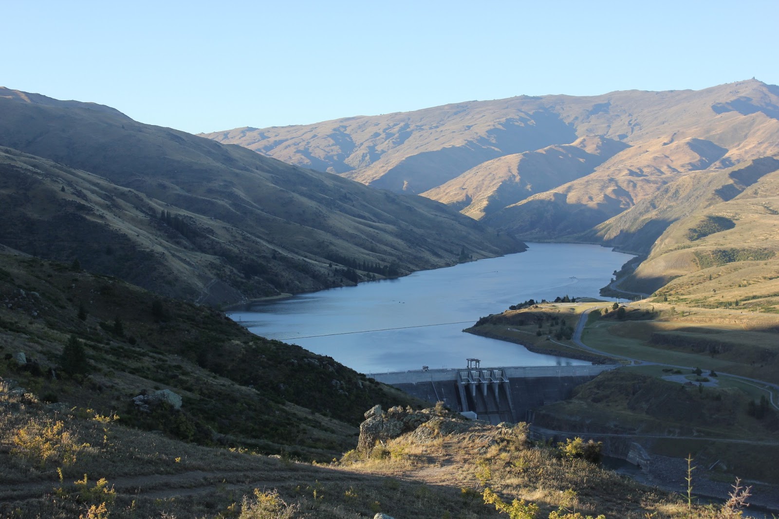 |
| The Dam wall, Clyde - Lake Dunstan behind the wall |
Looking down the valley made me think of photos of the
Derwent valley in Tassie. River lined
with poplars – all very English.

 |
| Me - blocking the view! |
Once
back down the mountain, we took a short walk along the River trail, an
alternative track between Clyde and Alexandra.

Here the river really rips past after being let out of the dam. It would be a really nice bike ride to loop
along the River trail and back along the Rail trail – about 25km.
So a very pleasant evening was spent chatting and catching
up on each others’ news.
No comments:
Post a Comment